Scientist Profile

Dr. B. S. Murthy
Designation
: Retired Scientist
Phone
: +91-(0)20-25904341
Fax
: +91-(0)20-25865142
Email ID
: murthy[at]tropmet[dot]res[dot]in
| Degree | University | Year | Stream |
|---|---|---|---|
| Ph.D. | Pune University | 2001 | Atmospheric Physics |
| M.Sc. | Andhra University | 1986 | Physics |
| B.Sc. | Andhra University | 1984 | Physics, Mathematics, Chemistry |
 Thunderstorm dynamics and atmospheric electricity
 Atmospheric pollution - chemical speciation
 Atmospheric boundary layer studies: aerosols, fluxes, trace gases
 Air-sea-land interactions
| Award Name | Awarded By | Awarded For | Year |
|---|
| Year | Designation | Institute |
|---|---|---|
| 2020-Present | Scientist F | Indian Institute of Tropical Meteorology, Pune |
| 2014-2020 | Scientist E | Indian Institute of Tropical Meteorology, Pune |
| 2007-2014 | Scientist D | Indian Institute of Tropical Meteorology, Pune |
| 2003-2007 | Scientist C | Indian Institute of Tropical Meteorology, Pune |
| 1998-2003 | Scientist B | Indian Institute of Tropical Meteorology, Pune |
| 1993-1998 | Junior Scientific Officer | Indian Institute of Tropical Meteorology, Pune |
| 1988-1993 | Senior Scientific Assistant | Indian Institute of Tropical Meteorology, Pune |
Research Highlight

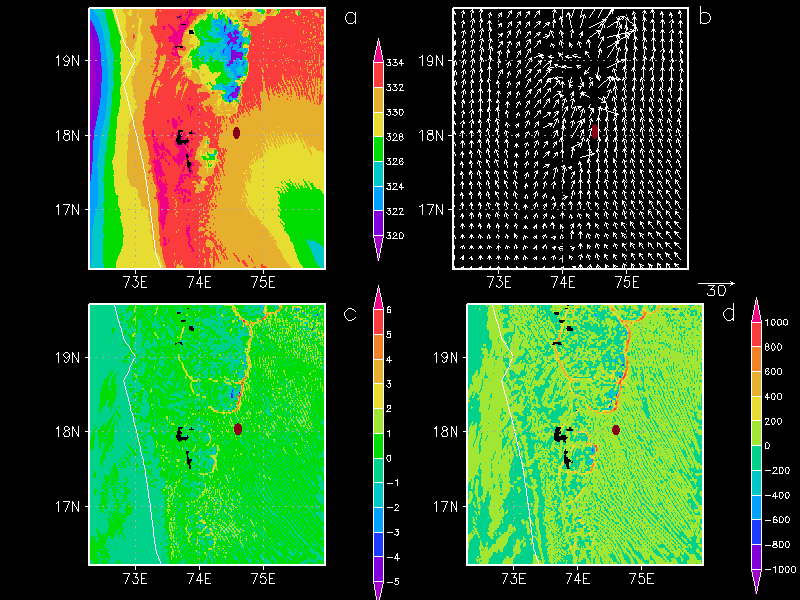
WRF simulation of a severe hailstorm over Baramati: a study into the space-time evolution
A severe hail storm that occurred over Baramati (18.150N, 74.580E, 537 m AMSL) on March 09, 2014 has been studied in terms of its initiation, organization and movement by analyzing space-time evolution of WRF-simulated radar reflectivity, vertical velocity and moisture convergence. A physical mechanism, proposed as a conceptual model, signifies the role of multiple convective cells organizing through outflows leading to a cold frontal type flow, in the presence of a low over the northern Arabian Sea, propagates from NW to SE triggering deep convection and precipitation. A ‘U’ shaped cold pool encircled by a converging boundary forms to the north of Baramati due to precipitation behind the moisture convergence line with strong updrafts (~ 15 ms-1) leading to convective clouds extending up to ~ 8 km in a narrow region of ~ 30 km. The outflows from the convective clouds merge with the opposing southerly or southwesterly winds from the Arabian Sea and southerly or southeasterly winds from the Bay of Bengal resulting in moisture convergence (maximum 80*10-3 g kg-1 s-1). The vertical profile of the area-averaged moisture convergence over the cold pool shows strong convergence above 850 hPa and divergence near the surface indicating elevated convection.


